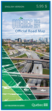
Québec Official Road Map
Printer-ready
maps are in Acrobat Reader PDF format .
The maps on this site are drawn, by tourist region, from the
Québec
Official Road Map, 2023 edition, which was prepared by the ministčre des Transports et de la Mobilité durable, published and sold by Les
Publications du Québec.
There are three navigation levels:
- The entry-level map of southern Québec allows a tourist
region to be chosen and opens a basic map of that region.
- Regions not shown on the entry map may be consulted on the
map
of Québec, scale: 1:11 000 000.
Regional maps provide a basic view of a chosen region and its
major roads. Clicking on the map opens a detailed map of the
territory. The basic map also allows major urban centres to
be enlarged (detailed map) by clicking on the pink zones.
- Detailed maps may be printed in the 215 mm x 280 mm (8½ in.
x 11 in.) format or, in some cases, in the 215 mm x 355 mm
(8½ in.
x 14 in.) format. Each map is as detailed as the printed map
and may be displayed using the
Acrobat Reader freeware, which must be installed on your computer.
The Acrobat Reader Edit menu allows you to specify the degree
of magnification of the maps (Edit/Preferences/Display/Magnification). Inhabited
place names are found by using the Acrobat Reader Find
command
 . .
A legend
is provided to facilitate comprehension of the map symbols used.
Any errors or omissions can be pointed out by contacting the
authors of the
map.
The Québec Official Road Map also features:
|